Qlik New Logo 2024

Qlik GeoAnalytics

Geospatial visualization and analysis

Qlik Geoanalytics Analisi Dati Geospaziale

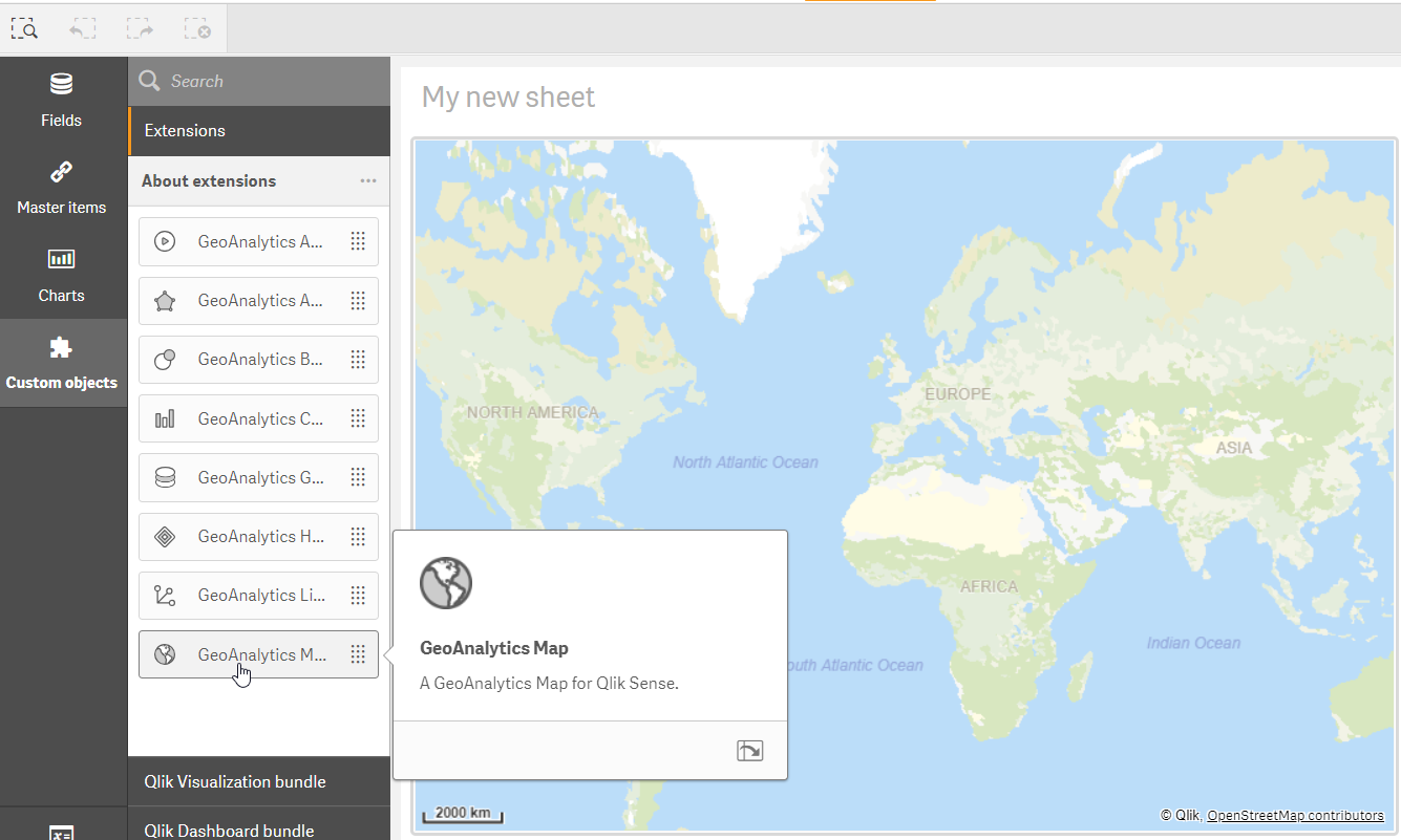
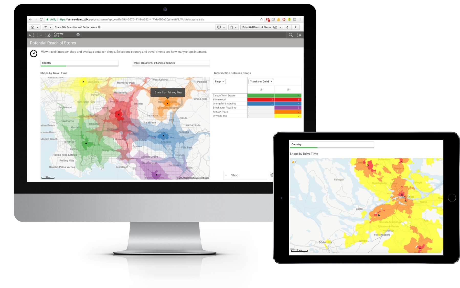
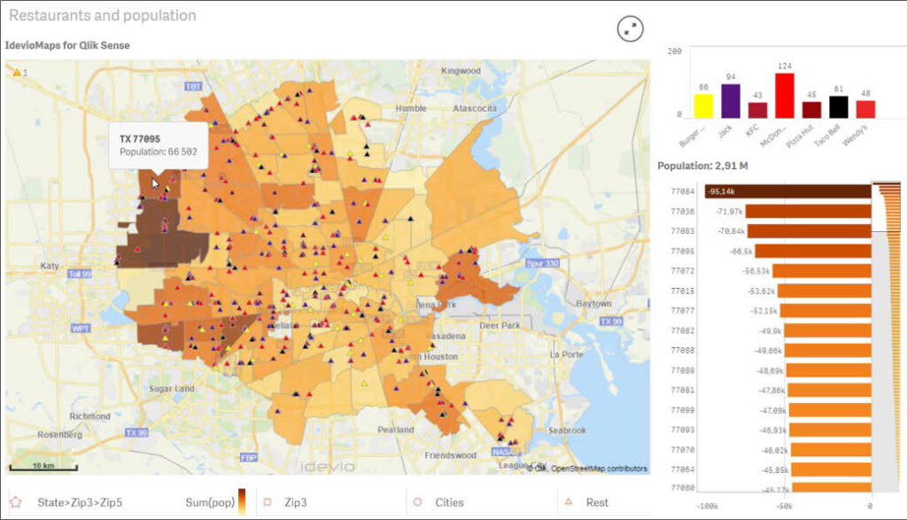
Powerful geographic views and location-based analytics for both Qlik Sense and QlikView using patented technology that compresses and scrolls mapping data.

Add maps easily using the automatic ‘geo-data lookup’ and then overlay them with different views. Analyze geospatial or geographic data in combination with non-geographic data to uncover hidden relationships.

Our specialists are also experts in understanding the major business processes related to sales, manufacturing, logistics, finance and administration in addition to Qlik.

Thanks to our network of consultants and partners, we have already carried out more than 100 projects on Qlik with customers throughout the country.

What can you do with Qlik GeoAnalytics®?

Make better location-related decisions

Prendi decisioni migliori legate alla localizzazione con Qlik Geoanalytics

Many important organizational choices such as location choice, resource allocations or lead times depend on location information. Maps provide a visual context that helps customers at Qlik make correct, informed decisions involving location.

  • Analyze geospatial relationships (and discover non-relationships) using Qlik’s associative model.
  • Choose from a large selection of GeoAnalytic operations.
  • Combine internal and external sources in the calculations.

Improve understanding

Qlik can now increase the narration of the data as the map is familiar to most users. With the ability to quickly display cartographic information, users can obtain information on models that are not easily interpreted through tables or graphs to better understand all the history that lives within their data.

  • Seamless drill-down by geographic area. Use different views in the drill-down levels.
  • Multiple levels and types of visualization.
  • Manage information dense maps that contain thousands of points.

Increase productivity

With the ability to instantly integrate location data such as cities and countries with the necessary geo information, any Qlik user can now add rich and interactive geo views to their Qlik applications. And since all Qlik mapping products and tools run on the same platform, customers can easily expand their mapping solution by building on their own implementation.

  • Quickly and easily build maps without coordinates, using country, region, zip codes or just entering names.
  • Define views that use measures and expressions.
  • Draw lines and arcs between locations.

Geospatial information and geographic relationships essential for decisions that know where they want to go

Qlik GeoAnalytics provides access to powerful geographic visualizations and location-based analytics, for both Qlik Sense and QlikView, using patented technology that compresses and scrolls mapping data.

Search, view and discover hidden relationships

Ricerca, visualizza e scopri le relazioni nascoste con qlik geoanalytics

With the automatic ‘geo-data lookup’ you can easily add your maps and cover them according to different views. The geospatial and geographic data collected can combine with the non-geographic data and then discover all the hidden relationships.

No doubts about your choices, thanks to ever more precise information


The choice of the location, where to allocate the resources, establish the delivery times, are fundamental organizational choices that depend on information on the location. Thanks to GeoAnalytics maps you will have a visual context that will help you make the right decisions. More precisely, what you can do is:

  • analyze geospatial relationships (and discover non-relationships) using Qlik’s associative model;
  • choose from a large selection of GeoAnalytic operations;
  • Combine internal and external sources in the calculations.

Your data will tell
a story


For most users, the map is a familiar environment, which is why with Qlik GeoAnalytics we are able to increase the narration of the data.

Thanks to the ability to quickly display cartographic information, users can obtain information on models that are not easily interpretable through tables or graphs, to better understand all the history that lives within their data.

So here’s what you’ll get:

  • seamless drill-down by geographic area;
  • multiple levels and types of views;
  • management of dense maps of information that contain thousands of points.

Insights

More information, more productivity

Location data – such as cities and countries – integrate instantly with geo information: each user can integrate rich and interactive geo views into their Qlik applications. Expanding your mapping solution will be very easy as all mapping products and tools work on the same platform.

Thanks to GeoAnalytics you will be able to:

  • quickly and easily build maps without coordinates, using country, region, zip code or simply by entering names;
  • define views that use measures and expressions;
  • draw lines and arcs between locations

Would you like more information about this product?

Contact us by filling out the contact form. Our consultants will get back to you within 24 hours!